Take action with high frequency road data
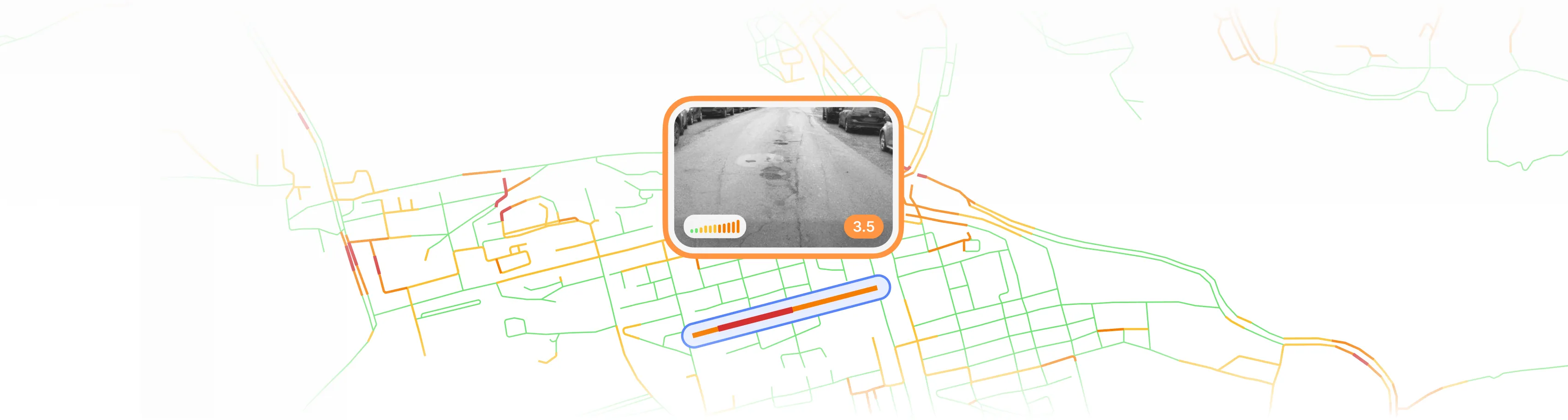
Automatic distress detection through AI
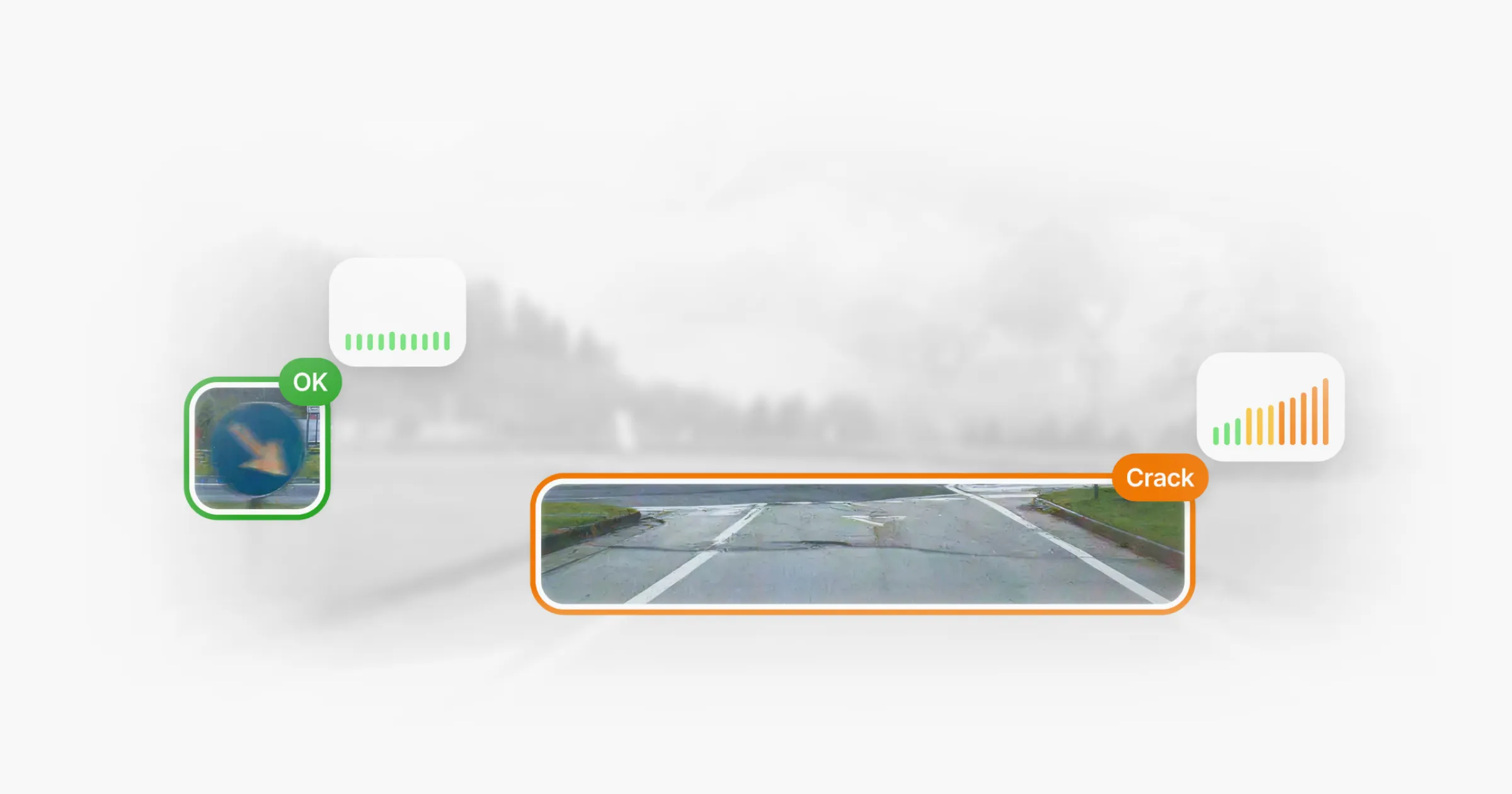
Potholes, cracks, deformation and unevenness are identified across the network.

3D reconstruction
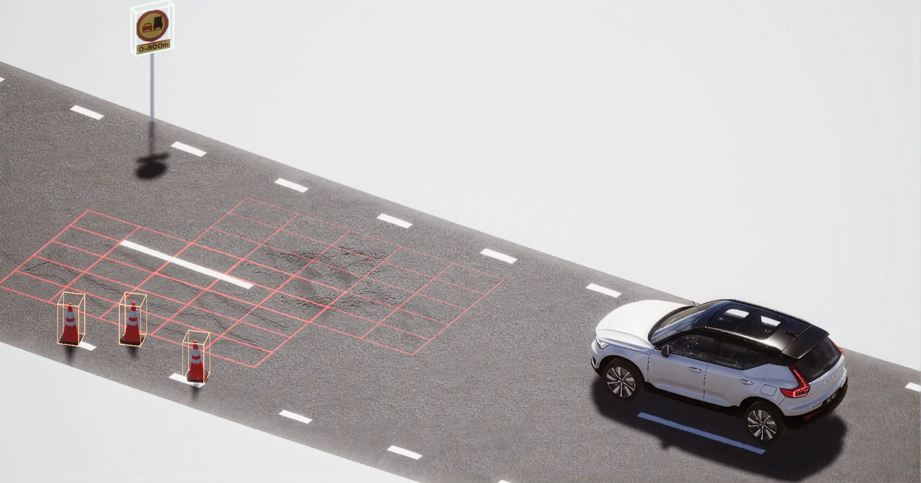
Each distress is reconstructed in three dimensions and placed in its real-world location, not simply marked on an image.
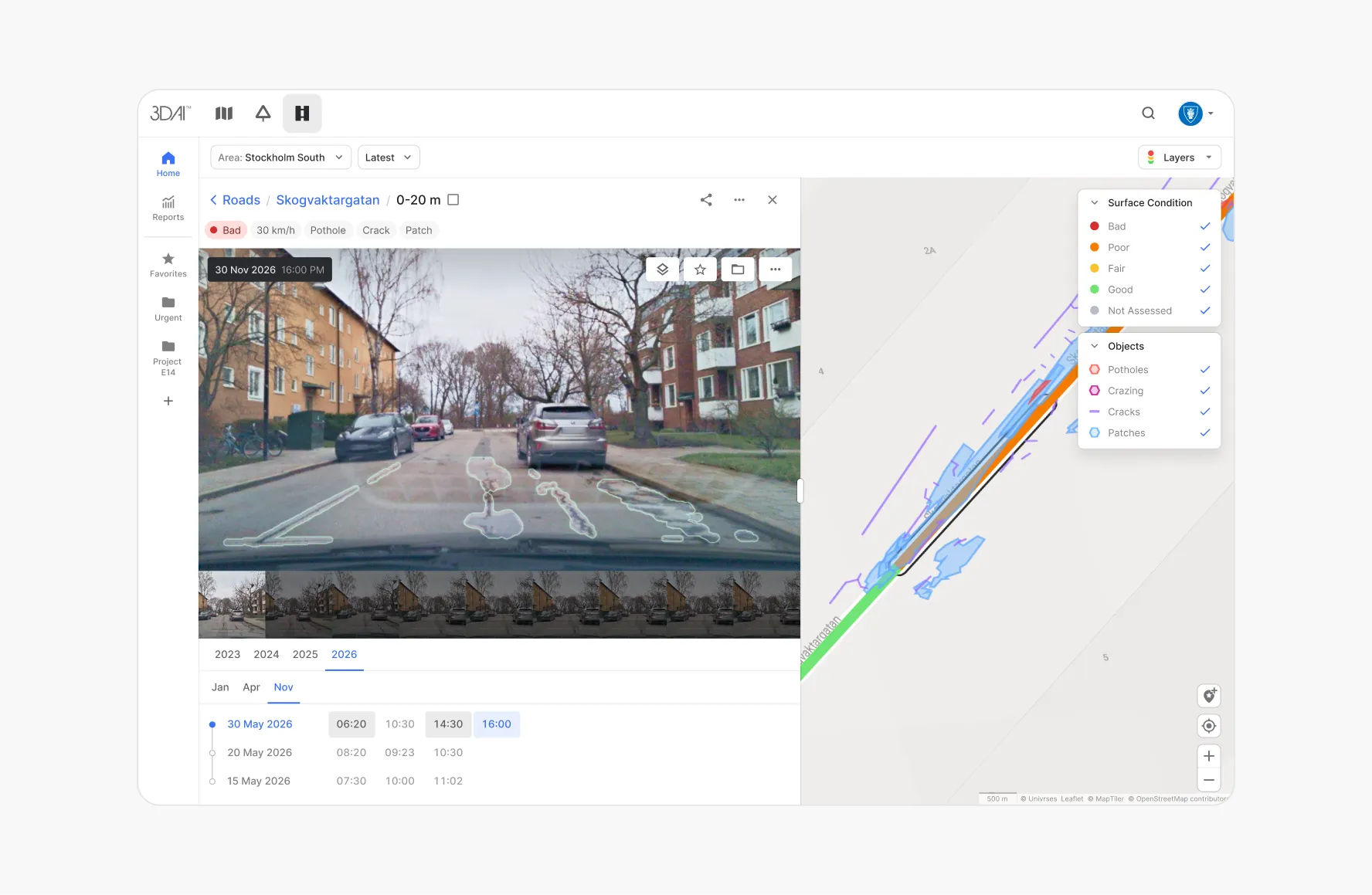
Inspect across
space & time
Forget yearly inspections – with 3DAI you get continuously updated data about your road network. Built from your own journeys and available whenever your teams need it.
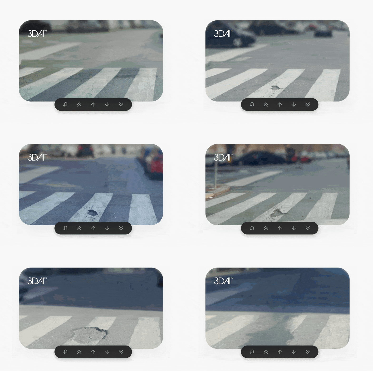
Captured during normal operations
Road condition is analysed as vehicles drive, with no dedicated survey runs.
Clear prioritisation
Defects are ranked by severity, urgency and change over time, and linked to the relevant road segment.
Pavement-management metrics
Indicators such as IRI, PCI and RMS3 unevenness support long-term planning and budget justification.
Lower maintenance debt
Earlier intervention keeps repairs economical and strengthens network resilience.
System integration
Structured, geolocated data exports directly into existing pavement and asset management systems.
Connected-vehicle and smart-tyre data
Imagery can be combined with vehicle signals and Pirelli Cyber Tyre data to detect change before it becomes a visible defect.
Every road has a story to tell
Some signs are obvious — potholes, cracks, surface failures, emergency repairs. Others appear slowly, hidden in small changes in texture, roughness, unevenness, or recurring deterioration patterns.
3DAI™ helps road owners, municipalities, contractors, and infrastructure operators read that story earlier, more clearly, and with objective evidence.
By combining continuous road imagery, automotive-grade perception, 3D reconstruction, and geolocated surface analysis, it builds a dynamic view of pavement condition across your network — detecting, reconstructing, mapping, ranking, and tracking surface distresses over time, from potholes, cracking, and rutting to longitudinal and transverse defects, ravelling, patching, deformation, and unevenness.
This isn't image highlighting. 3DAI™ reconstructs distresses in 3D and places them in their real-world geographic context. Each defect is linked to its location, road segment, severity, and evolution over time — making the data practical for inspection, prioritisation, reporting, and pavement management.
The result is a living digital twin of your road surface: visual, spatially accurate, continuously updated, and built for better maintenance decisions.
Every journey becomes a survey
Maintaining a road network means balancing today's defects against tomorrow's investments — addressing immediate safety concerns while understanding how the network is changing and where limited budgets deliver the most long-term value.
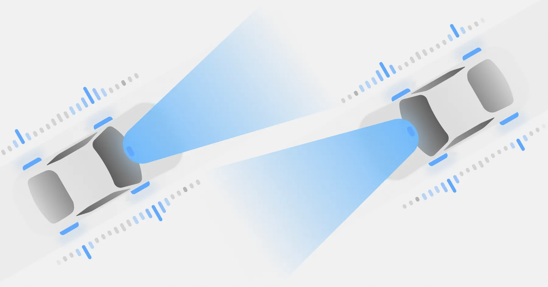
Unlike traditional surveys that rely on specialised vehicles and expensive sensor systems, 3DAI™ uses simple, cost-effective cameras built on technology originally developed for autonomous driving. Condition data can be collected at scale from multiple vehicles across the network. Every journey becomes a survey opportunity.
As vehicles repeatedly travel the same roads, data is automatically aggregated into a richer, more accurate picture of network condition. Instead of periodic snapshots, road authorities get continuously refreshed insight into how assets are changing.
From reactive repairs to proactive maintenance
Road maintenance is never just one problem. Some issues need immediate action; others need careful planning, budget justification, and deterioration modelling. 3DAI™ supports both.
For reactive maintenance, it detects urgent issues — potholes, large cracks, and safety-critical defects — ranked by severity, linked to specific road segments, reviewed visually, and exported into existing workflows. Teams respond faster, document what was found, and reduce the risk of missed defects.
For proactive maintenance, it identifies deterioration trends before they become costly failures. By combining visual analysis, inertial data, road network properties, and proprietary condition algorithms, it supports pavement indicators such as IRI, PCI, RMS3 unevenness, and other metrics used in pavement management systems. This lets owners intervene while it still makes economic sense — before damage accelerates, maintenance debt grows, and resilience is compromised.
A stronger perception layer for the physical road network
3DAI™ is built on algorithms from the automotive world, where perception, sensor fusion, and real-time understanding are essential.
On demand, it can integrate connected-vehicle data such as friction, roughness, and tyre–road interaction signals. These are matched against 3DAI's imagery, cross-checked with visual evidence, cleaned of inconsistent readings, and turned into reliable infrastructure intelligence.
It's also compatible with smart-tyre ecosystems such as Pirelli Cyber Tyre, where tyres act as sensing elements for grip, surface irregularities, and driving conditions. Combined with visual surface analysis, smart-tyre data enriches the network's perception layer and helps flag early changes — reduced friction, emerging unevenness, surface degradation — before they become visible defects. The result is a richer digital twin that reflects not just what the road looks like, but how it performs.
Built for existing networks
3DAI™ works with your existing data environment rather than replacing it. It's backwards compatible with existing survey datasets and asset management workflows, so you can combine new observations with historical data and keep continuity in reporting and performance measurement.
Turn road surface data into decisions
With 3DAI™, you can:
- Detect potholes, cracks, deformation, and other distresses automatically
- Reconstruct distresses in 3D, not just highlight them on images
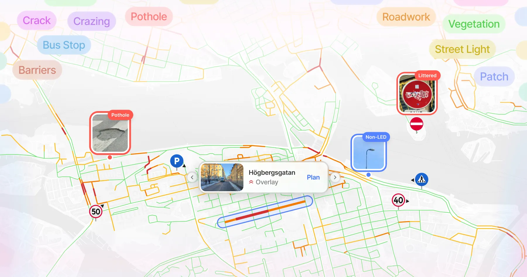
- Locate defects geographically and link them to road segments
- Rank issues by severity, urgency, and evolution over time
- Support reactive maintenance and urgent issue detection
- Enable proactive maintenance and long-term rehabilitation planning
- Track deterioration trends across the network
- Feed pavement management systems with structured, visual, geolocated data
- Integrate connected-vehicle and smart-tyre data on demand
- Reduce maintenance debt and strengthen resilience through earlier, better-informed intervention
- Export findings into existing workflows, dashboards, and asset management tools
Know what is happening. Decide what happens next.
Road maintenance decisions are only as strong as the evidence behind them. 3DAI™ gives road owners, contractors, municipalities, and infrastructure operators a clearer view of pavement condition across the network — helping teams prioritise repairs, defend budgets, verify intervention needs, monitor contractor performance, and plan rehabilitation on objective, repeatable, visually backed data.
From urgent issue detection to long-term pavement management, it helps you understand what's happening on your roads today — and where to act before tomorrow's problems get more expensive.
A new era for
road maintenance
Take action on roads with 3DAI™


Deployed in 15+ countries together with national road authorities & organisations.











Latest