England had 110 000 streetlights classified in 90 days

Univrses has completed the first AI-powered survey of a national road system, delivering an accurate streetlight inventory across Englandʼs Strategic Road Network. In partnership with WSP Global Inc., Univrses used its AI-powered system, 3DAI™, to provide National Highways—the operator of Englandʼs major roads—with precise asset data, directly supporting their operational efficiency and Net Zero objectives.
The Challenge
National Highways manages 7,200 km of roads, ensuring safe and efficient travel for millions of users every day. A crucial part of this infrastructure is its vast network of approximately 117,000 streetlights. Street lighting costs National Highways several tens of millions of pounds annually in electricity and accounts for 58% of their corporate carbon footprint, contributing more than 15,000 tonnes of CO₂ annually. National Highways has been working to upgrade a significant portion of its streetlights from traditional luminaires to energy-saving LEDs. This transition is a key part of NationalHighwaysʼ strategy to reduce electricity costs, cut carbon emissions, and support its long-term goal of achieving Net Zero corporate carbon emissions by 2030.To plan this transition, measure progress and to forecast future energy savings, National Highways relied on an existing inventory of the street lights. However, it soon became apparent that this data was incomplete and outdated. This created major uncertainties, directly impacting National Highwaysʼ financial and operational planning:
- Unclear planning for future upgrades – Missing or outdated records made it difficult to plan and execute the LED conversion program as well as optimize general maintenance of streetlights.
- Unverified LED upgrades & billing discrepancies – a lack of up-to-date records complicated efforts to verify current energy consumption and made accurate assessment of electricity costs impossible.
- Inaccurate cost projections – Without precise data on streetlight types and locations, National Highways was unable to estimate energy savings and the long-term financial impact of the transition to LEDs.
As such, there was a clear need to create an up-to-date inventory of National Highways streetlight assets. Traditionally, carrying out an inventory of such an extensive streetlight network requires labor-intensive manual surveys. These surveys pose significant safety risks as personnel must carry out their surveying tasks near live traffic. Reducing this risk was a key driver in National Highwaysʼ decision to explore an alternative approach.Beyond safety concerns, the financial and logistical strain of manual inspections is significant. A full manual inspection of the road network would have required approximately 2,000 night shifts. With each night shift costing £5,000 per km surveyed, surveying costs alone (not accounting for traffic management or road closures) would have amounted to millions of pounds—a cost that was prohibitively large.
The Solution: Accurate streetlight data, powered by AI
In considering how to address the challenge, several automated approaches were explored—including the adoption of technologies such as LIDAR, optical imaging, satellite analysis and machine learning.
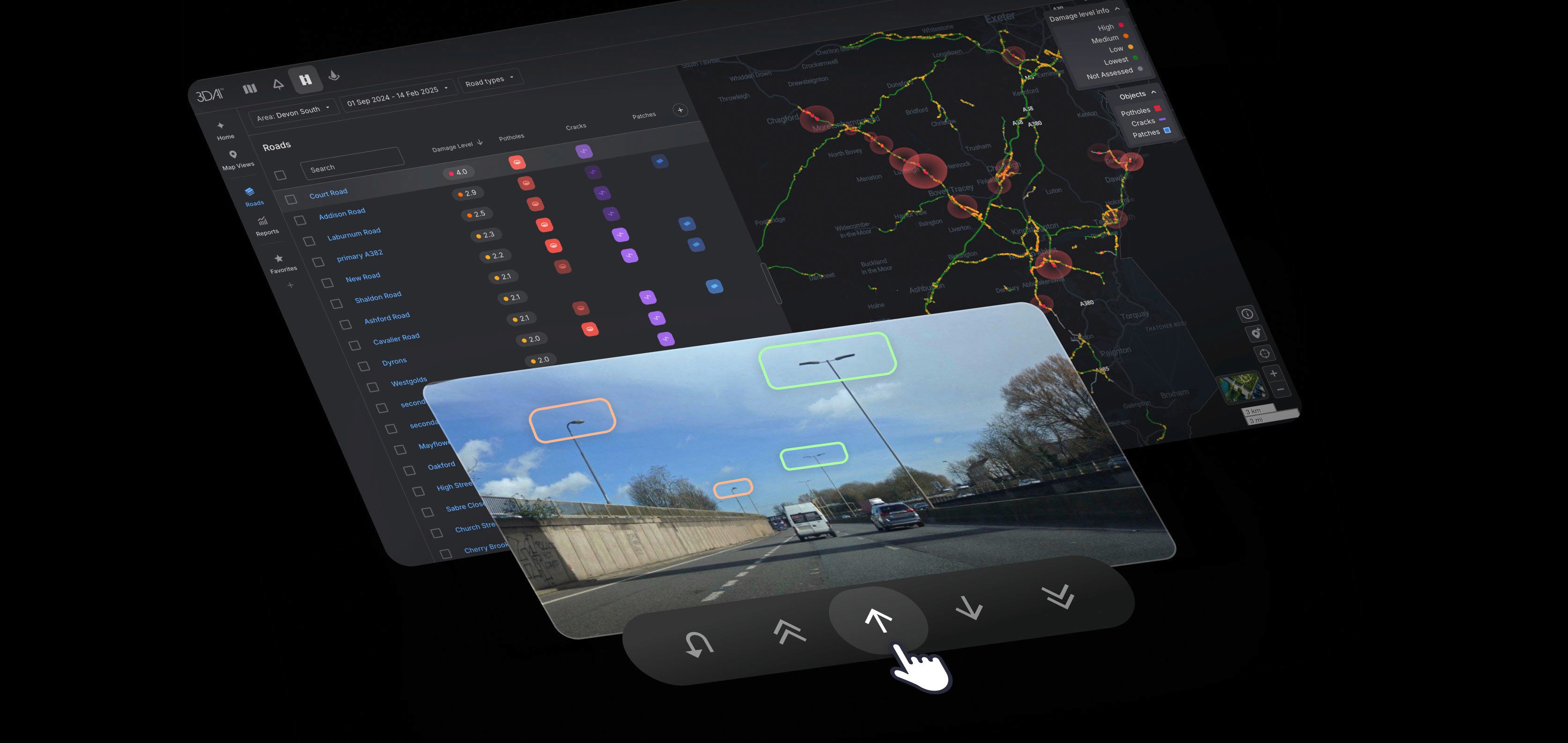
Univrses' AI-powered system, 3DAI™, was selected as the most effective solution. It is based on optical image capture and machine learning, and offers the best balance of speed, cost-efficiency, and precision.
Univrses deployed the system across the network, enabling detection, classification, and positioning of more than 100,000 streetlights in less than 3 months. The output was a structured dataset that National Highways could integrate into its asset management systems to inform decision-making and track the progress of LED upgrade and maintenance programmes. WSP reviewed and validated the results, ensuring the data met strict quality standards before being delivered to National Highways.
The Process: Automated streetlight detection
1. On-road data collection
Standard vehicles equipped with Univrsesʼ 3DAI™ system captured imagery while driving the network—no traffic disruptions or manual inspections required.
2. Detection and classification
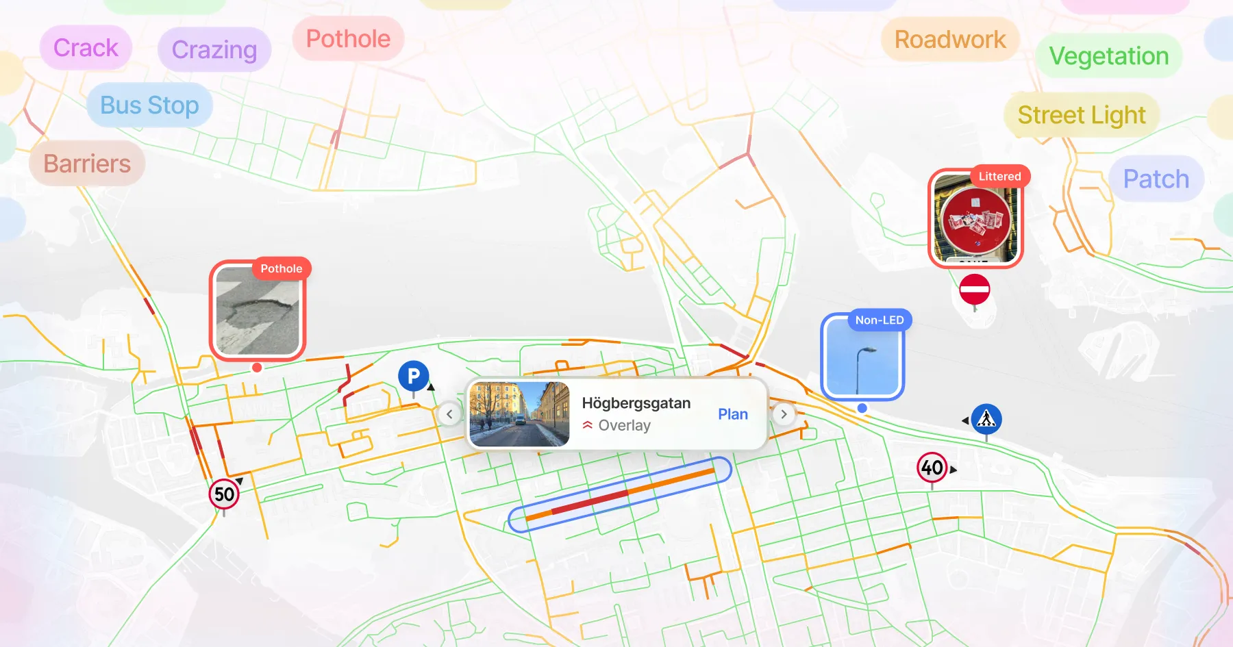
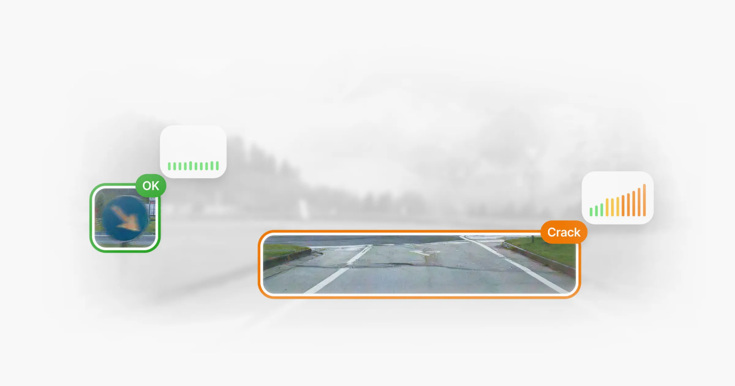
Streetlights were automatically detected in the imagery and classified as LED or non-LED based on visual characteristics using trained machine learning models.
3. Positioning and accuracy
Each detection was assigned a precise geolocation using triangulation. Multiple vehicle passes were automatically merged to improve reliability and filter out obstructions.
4. Validation and delivery
WSP conducted targeted reviews to verify classifications and positioning. Univrses applied quality assurance measures throughout to ensure consistency and accuracy.
The Result: Bridging the gap between records and reality
A complete and accurate overview of the network
The AI-powered survey covered 8,800 kilometres of Englandʼs road infrastructure, including slip roads, and detected and classified approximately 110,000 streetlights. More than 15 million images were captured (and anonymised), resulting in the most complete dataset National Highways has ever had on its lighting assets.
Accuracy was high across the board—WSP confirmed that 95% of detections made by 3DAI™ required no adjustments, and only minor refinements were needed for the remaining 5%. The survey also revealed that over 50% of the existing streetlight records were inaccurate and required updates.
Efficient, cost-effective data collection
A full manual survey of the same network would have required thousands of person-hours and cost tens of millions of pounds. By contrast, 3DAI™-powered data collection was completed for a small fraction of that time and cost - without the added disruption of road closures or the need for on-site inspection teams.
Stronger decisions, aligned with sustainability goals
With a more accurate dataset, National Highways can now better track LED upgrades, ensure energy bills reflect actual infrastructure, and plan maintenance more effectively. Initial estimates show that millions of pounds will be saved annually with this new data. This also supports their long-term Net Zero strategy by enabling more precise tracking of carbon-saving upgrades across the network.
Data privacy
All data captured by 3DAI™ is fully anonymised. No personal information is stored, and the system is compliant with GDPR and other relevant privacy regulations.
“Decisions are only as good as the data theyʼre based on. Getting high-quality insights fast means time and resources can be allocated not based on assumptions—but on what was actually happening on the ground.”
- Jonathan Selbie, CEO, Univrses
The Future: Unlocking the full potential of AI
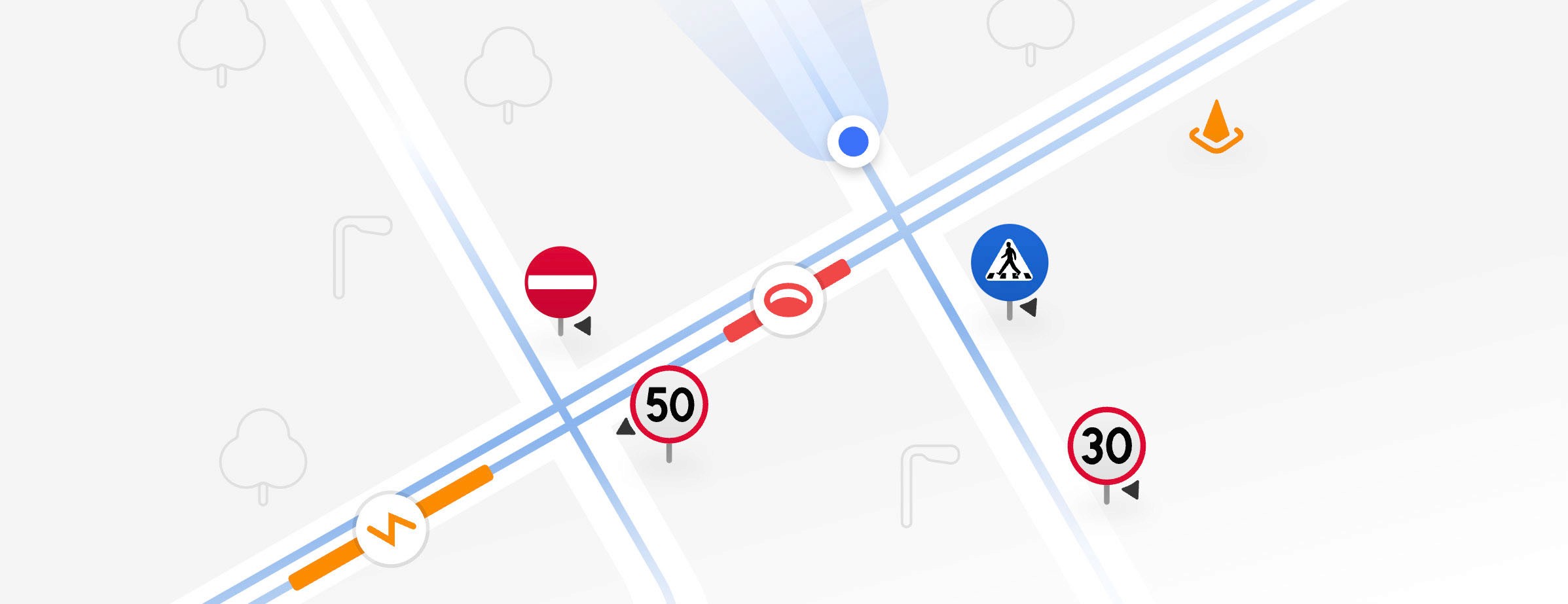
The success of this project laid the foundation for how AI-powered monitoring could support broader asset management. While this initiative focused on streetlights, the same technology can be applied to other roadside assets—such as traffic signs, road markings, and safety barriers—across the Strategic Road Network.
3DAI™ can also be leveraged to maintain accurate asset records over time - a key priority for National Highways. By deploying 3DAI™ regularly, National Highways can automatically validate its inventories by comparing new detections with past data to confirm if a streetlight, or any other asset, is still in place or has been removed or relocated. This streamlines data collection workflows and helps to maintain trust in the data.
In the next phase, data from multiple vehicles detecting various assets will be continuously merged into a single, evolving intelligence layer—eliminating fragmented datasets and reducing the need for extensive manual and dangerous data collection. Instead of relying on outdated survey data, authorities will have a continuously refreshed source of up-to-date information on road conditions—allowing road managers to track changes dynamically, anticipate risks, and plan with precision.
This project has demonstrated the value of AI-powered perception in large-scale asset management. By showing that high-accuracy data collection is feasible at national scale, National Highways and WSP can now explore broader applications of 3DAI™—enhancing road network operations and supporting long-term Net Zero targets.
“When we first considered using 3DAI™ for infrastructure monitoring at this scale, we genuinely weren't sure what to expect. It was entirely new territory. Having now seen the results, we're actively encouraging other teams and clients to adopt this approach. Itʼs given us a new perspective on the value of AI in infrastructure management.”
- Nick Griffin, WSP Project Lead

About Univrses
Univrses is a leading computer vision and AI company specialising in software that provides autonomous systems with advanced perception capabilities. The company has collaborated with major automotive manufacturers to develop software components that are now deployed in production vehicles, including flagship models such as the Polestar 3 and Volvo EX90.
Leveraging its strong foothold in the automotive sector, Univrses has expanded into the trillion-dollar asset management market by harnessing data from regular passenger vehicles. Through its proprietary algorithms, the company transforms raw sensor data into actionable insights that are critical for efficient asset management.
This data enables a detailed, real-time understanding of road infrastructure, including road conditions, traffic signs, lane markings, and street lighting. The AI system can also be used to monitor and analyse ongoing projects, such as roadworks and construction sites. By leveraging these insights, cities and road authorities can make better decisions, allocate resources more efficiently, reduce CO₂ emissions, lower costs, and improve road safety.
With a well-established market presence, Univrses helps cities, road transport authorities, and contractors achieve significant annual cost savings—potentially hundreds of millions of euros per country. The companyʼs proprietary 3DAI™ solution has already been deployed by national road network authorities in six European countries, including Sweden, Denmark, Norway, the Netherlands, the UK, and Italy.
Transform your asset management
Want to explore how 3DAI™ can transform your asset management?
Continue reading








Deployed in 15+ countries together with national road authorities & organisations.