Fixing roads before they break: How AI is transforming asset management
The European infrastructure deficit
Europe's roads are wearing out faster than they can be repaired. The European Central Bank (ECB) estimates a €900 billion public funding gap for infrastructure investment among EU member states.
The Swedish Transport Administration claims that closing the country's road maintenance backlog would require 20.9 billion SEK annually through 2037 — roughly 3 billion above current spending levels, despite a recent increase in government funding. Meanwhile, in the UK, the road repair backlog has reached £12.1 billion, requiring more than a decade to clear under current funding levels.
Here at Univrses, we believe that this funding gap isn't just the result of limited budgets — it has been created by deep inefficiencies in how road networks are monitored, and maintained. Across Europe, cities and Road Transport Authorities (RTAs) are struggling with aging infrastructure, locked into short-term maintenance cycles by assessment methods that are based on old technologies that fail to deliver the insights needed for long-term planning.
With unreliable data and limited visibility into their road networks, RTAs are forced to operate reactively. Maintenance becomes a series of expensive quick fixes prioritised by urgency rather than long-term value. As a result, resources are drained without lasting impact, and costs continue to rise.
To address this problem, authorities know what is needed — targeted interventions in the right place at the right time based on when and how the road is starting to deteriorate. Acting at this stage, before the asset has reached a poor condition, is less costly per intervention and extends the road's lifespan by many years. This approach offers a far more cost-effective way to maintain roads.
Why traditional road assessments fall short
Traditional assessment methods have evolved over time to enable the capture of a range of data about the roads. However, they are too expensive to deploy frequently, meaning most roads are only surveyed once a year — or even less. This leaves large gaps in the periods between surveys.
Manual inspections — still widely used — depend on people physically assessing road conditions, often in active traffic. They not only expose workers to risk but are also too infrequent to catch early deterioration across an entire network, making it difficult to maintain a complete and current view of road health.
High-tech scanner vans offer greater precision, but they're expensive to operate. The need for specialist hardware, trained crews, and complex software makes them impractical for frequent or wide-scale use.
Roads don't fail overnight — but without regular, network-wide monitoring, authorities miss the early warning signs. Deterioration follows patterns, and those patterns can be tracked, analysed, and acted on with the right response.
Artificial intelligence is changing the game
In order to shift from a reactive to a proactive approach, RTAs need to adopt a data-driven strategy that leverages condition data that is regularly updated as the network evolves. By identifying what to fix, where, and when, this kind of long-term plan ensures that budgets are used in the most effective way — delivering maximum impact from each investment. This shift requires accurate, real-time insight into the entire infrastructure network — something that, until now, has been out of reach.
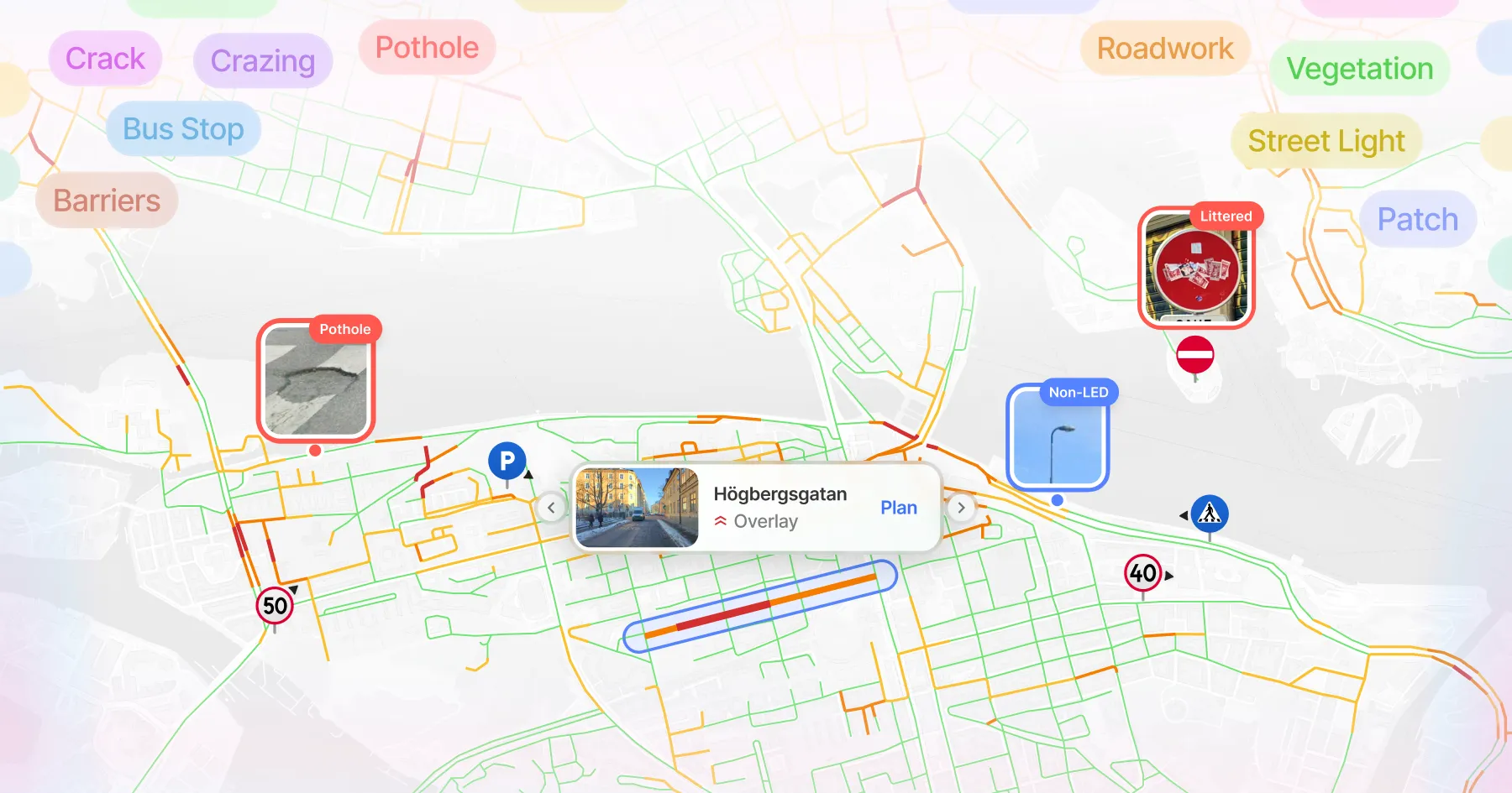
Univrses' 3DAI™ system gives cities and transport authorities a faster, smarter way to monitor road conditions. Leveraging AI, it frequently collects and analyses road data, delivering full network visibility in real time. In 2024 alone, 3DAI™ covered 950,000 km of roads and processed 94 million images into actionable insights — all without deploying a single custom survey vehicle.
Real-time road intelligence
Univrses' 3DAI™ is an AI-powered road monitoring system that gives transport authorities real-time visibility into road conditions — without the cost, delays, or blind spots of traditional inspections. The system runs on standard smartphones and can be installed in virtually any vehicle, turning everyday fleets into mobile data collectors.
Municipal fleets, taxis and buses are ideal carriers, covering the network continuously as they go about their routes. This enables large-scale monitoring without the need for dedicated survey vans or costly hardware. With precise, structured insights, asset managers can shift from reactive repairs to smarter, proactive maintenance — cutting costs, reducing emissions, and making better use of existing resources.

How 3DAI™ works
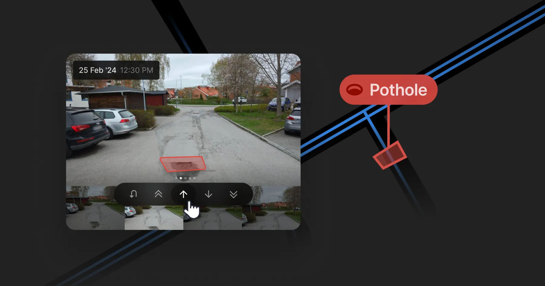
- Smartphone-based scanning. Vehicles equipped with 3DAI™'s smartphone-based vision system continuously scan road surfaces as they travel.
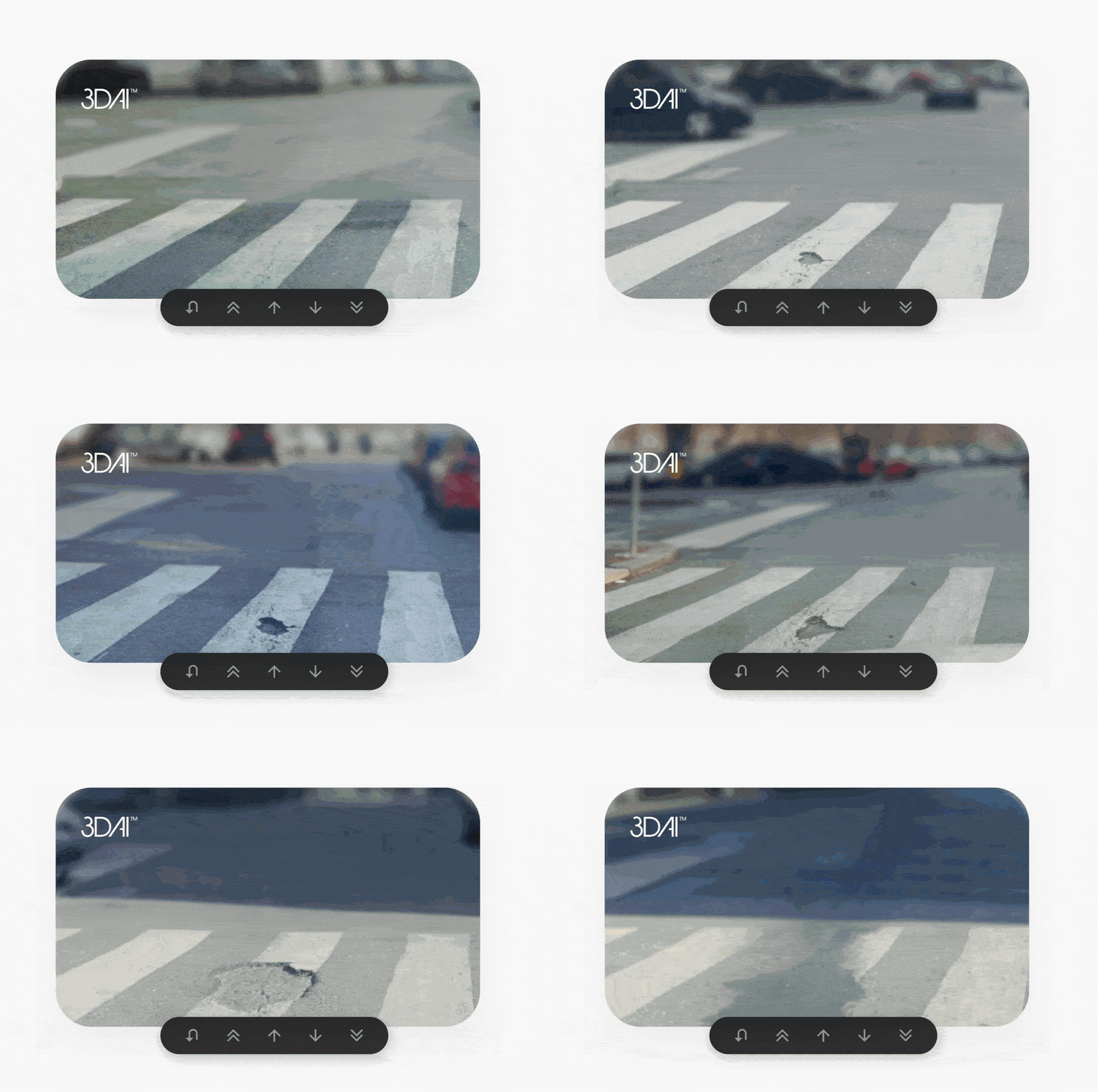
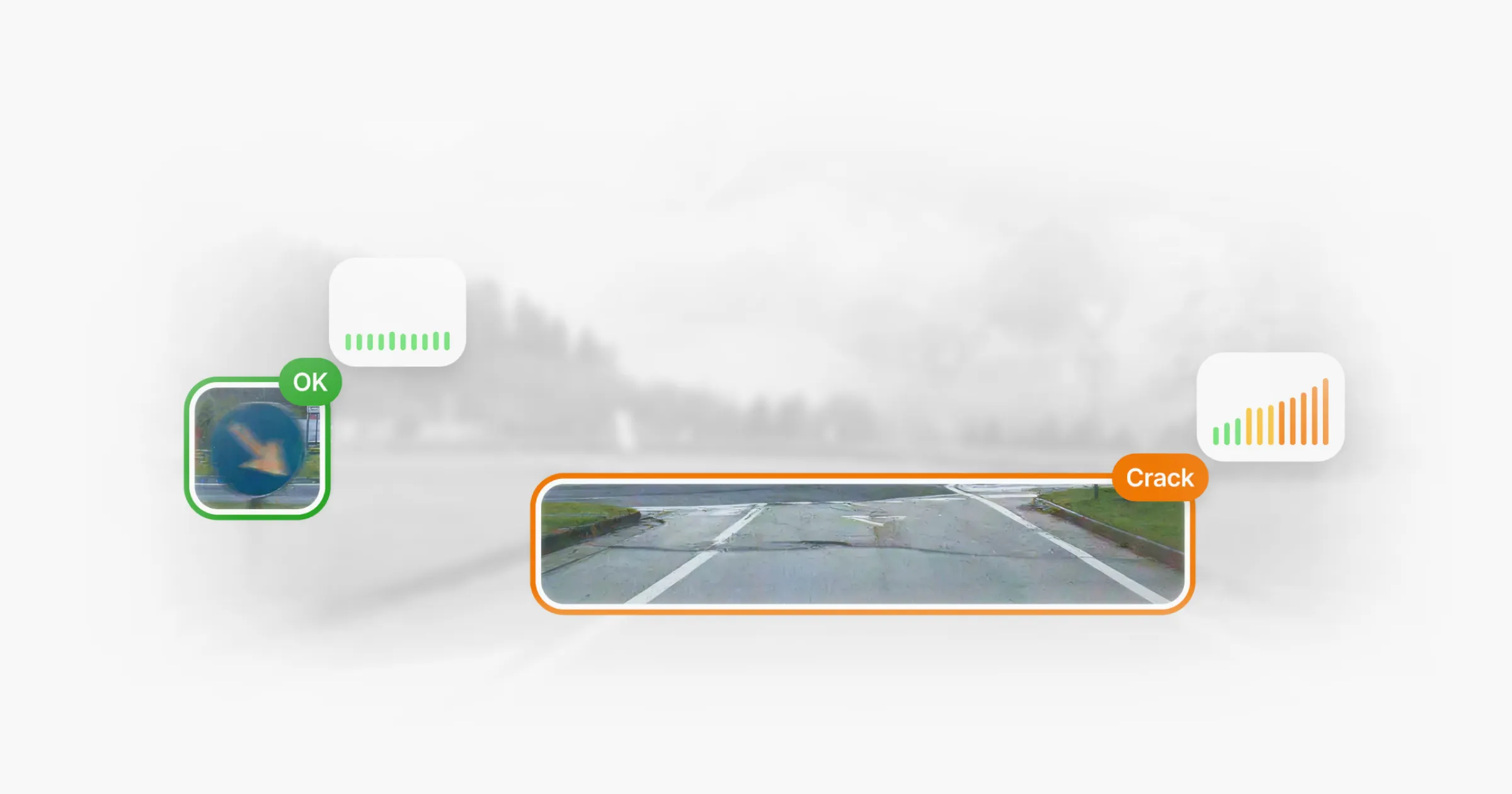
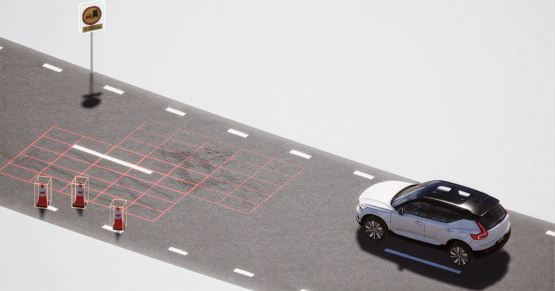
- AI-powered detection. Advanced computer vision algorithms detect road damages such as cracks, potholes, and surface wear — flagging issues before they escalate.
- On-device edge processing. Key data is processed directly on the device, reducing file sizes, lowering transfer costs, and accelerating initial analysis.
- Cloud refinement. Detections are uploaded to the cloud, where they're further structured and validated — ready to support accurate mapping and insight generation.
- Geo-referenced mapping. Each detection is mapped with precise GPS coordinates, anchoring it accurately within the road network.
- Trend analysis. As the network is covered over time, 3DAI™ identifies deterioration patterns — enabling smarter planning, prioritised repairs, and more cost-efficient maintenance strategies.
Trusting AI for asset management
For AI-powered road assessment to replace traditional methods, it must match or surpass the accuracy and reliability of existing industry standards. Asset managers need verifiable data they can trust for planning, budgeting and long-term maintenance strategies.
Proven accuracy and validation
3DAI™ has been rigorously tested to meet the accuracy and reliability standards required for critical asset management. Benchmarking by the Swedish National Road and Transport Research Institute (VTI) confirms that 3DAI™'s measurements align closely with established reference data.
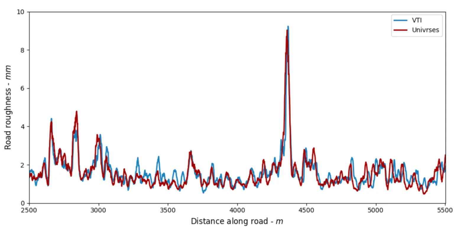
Comparison of a roughness index signal provided by VTI and 3DAI™ along a road segment in Sweden.
Adapting to the road
Unlike static survey methods, 3DAI™ adapts and improves with every kilometre driven. The system learns from diverse environments — refining its detection capabilities across changing road surfaces, weather conditions, and regional standards. This continuous learning loop enhances accuracy over time and ensures that insights remain relevant as networks evolve.
Structured and actionable data
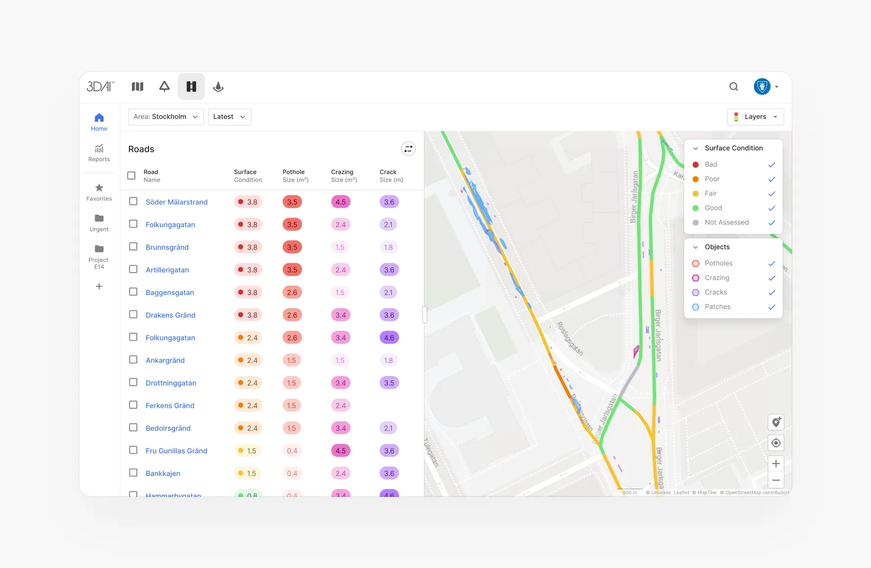
Beyond accuracy, 3DAI™ provides road data in a structured, consistent format. Networks are divided into uniform sections, each receiving a condition score that helps identify and prioritise critical areas for intervention. This gives asset managers a clear, objective basis for planning repairs and allocating resources.
Historical tracking capabilities further strengthen decision-making. By aggregating insights from repeated vehicle passes, 3DAI™ highlights how road conditions change over time — revealing deterioration patterns, evaluating maintenance outcomes, and supporting long-term planning. Delivered via API or web interface, the data integrates seamlessly with existing GIS workflows — enabling predictive maintenance strategies at scale.

Real-world impact: The Helsingborg model
The City of Helsingborg, Sweden, has transformed its approach to road maintenance with 3DAI™ — shifting from reactive repairs to proactive, data-driven asset management.
Like many cities, Helsingborg previously relied on traditional road inspections that were time-consuming, costly, and limited in coverage. Engineers spent 2.5 days per week on manual inspections, often working with asset data that was up to five years old. By the time damage was recorded, emergency repairs were often the only option.
With 3DAI™, the city now receives continuous, structured data on road conditions — enabling early detection of damage, smarter resource allocation, and better long-term planning. Instead of responding to problems after the fact, Helsingborg can now prevent them before they escalate.
The results
- At least €17 million in estimated cost savings by identifying and addressing road damage early and reducing expensive emergency interventions.
- Potholes reduced from 3,000 to just 900 in five months, improving road safety and reducing vehicle wear and tear.
- Inspection time cut from 2.5 days per week to one hour, freeing up resources for higher-value tasks.
- 50% of the manual inspection workforce reallocated, increasing efficiency without sacrificing road quality.
Looking ahead, Helsingborg expects long-term benefits through improved life cycle costing and more sustainable infrastructure planning. The city's success shows what's possible when AI becomes a core part of everyday road operations: less waste, better decisions, and infrastructure that lasts longer.
AI-powered insights and human expertise: A winning combination
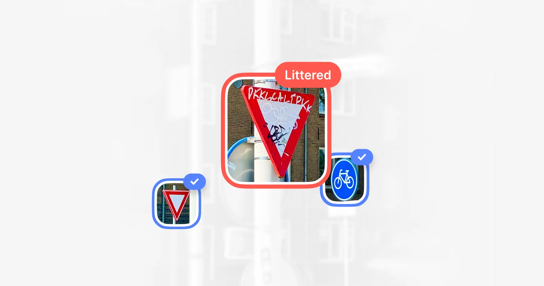
Asset management is at a turning point. The shift from reactive to proactive maintenance is no longer a distant goal — it's happening now. AI-powered systems are enabling authorities to monitor entire road networks in real time, anticipate failures before they happen, and allocate resources more efficiently. But as this transition unfolds, a key question arises: Does AI replace human expertise in asset management? No, it does not.
AI isn't a replacement — it's a force multiplier. Roads don't manage themselves. Infrastructure planners, engineers, and decision-makers bring the expertise, experience, and judgment needed to make the right calls. What 3DAI™ does is amplify their capabilities.
By delivering actionable insights, it removes the guesswork from decision-making — ensuring that asset managers have a structured view of road conditions and can prioritise the right actions at the right time. Instead of hunting for potholes and relying on outdated reports, they can shift focus to strategic resource allocation, long-term planning, and proactive interventions.
The future of asset management isn't about choosing between people and technology — it's about using them together, each making the other more effective.
The future of road intelligence
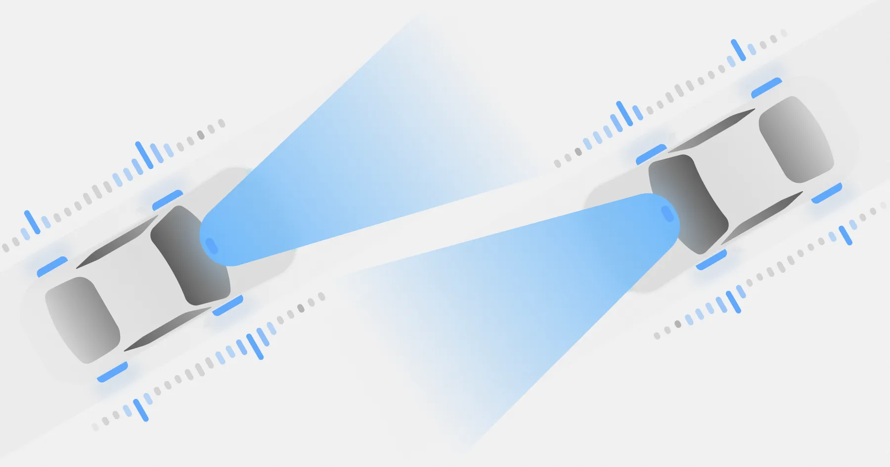
Over the next decade, autonomous and connected vehicles are set to become a familiar sight on our roads. Equipped with advanced sensors and cameras, these vehicles won't just navigate infrastructure — they'll monitor it.
With the ability to scan road surfaces continuously and generate massive amounts of data, they have the potential to become the world's most powerful road intelligence sources.
But to unlock this potential, transport authorities need more than raw data. Insights must be built on systems that can structure, merge, and continuously learn from millions of data points — creating a real-time, evolving picture of road conditions.
The good news is that this is already happening. While fully autonomous fleets are still some years away, Univrses has designed 3DAI™ to help authorities prepare for this future.
Use-Case Driven Digital Twins
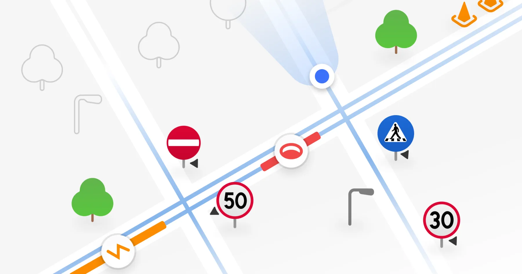
What sets 3DAI™ apart is how it structures and transforms incoming data into what we call Use-Case Driven Digital Twins. Unlike many digital twin projects, these are not just visual reconstructions — they're practical, purpose-built models tailored to asset management. Focused on long-term planning, lifecycle costing of road assets, and risk mitigation, they help authorities manage road networks that span tens of thousands of kilometres.
With each vehicle pass, this digital representation is enhanced, capturing real-world changes in near real time. Whether data comes from one, ten, or ten thousand vehicles, it is continuously merged into a single, evolving intelligence layer — eliminating fragmented datasets and reducing the need for extensive manual interpretation. Authorities gain an up-to-date source for tracking changes across the road network.

The next step
To accelerate this transition, Univrses is working with leading manufacturers (OEMs) to embed 3DAI™ directly into autonomous, connected, and ADAS-enabled vehicles. This means that in the near future, these vehicles won't just use infrastructure — they'll actively contribute to its upkeep.
This isn't just a technological upgrade. It represents a smarter, more sustainable model for asset management — where road intelligence is generated passively by vehicles already in operation. By tapping into existing mobility patterns, authorities can achieve continuous, wide-scale monitoring — without the need for dedicated survey fleets, and with lower emissions and greater efficiency.
As this capability becomes embedded in everyday mobility, cities and transport agencies can move toward a circular, data-driven model. Infrastructure will no longer be assessed periodically, but monitored, maintained, and improved in real time.
The road ahead is clear. With real-time intelligence, asset managers can stay ahead of infrastructure challenges — identifying risks early and fixing roads before they break. Every road, everywhere, at all times.
A new era for road maintenance
Take action on road data with 3DAI™
Continue reading




Deployed in 15+ countries together with national road authorities & organisations.