Nästa steg för trafiksäkerheten: AI ger nya möjligheter att förstå vägarnas tillstånd
Vilka risker missar vi?
Trafiksäkerheten i Europa har förbättrats kraftigt under de senaste decennierna. Det är en stor framgång. Två av de viktigaste drivkrafterna har varit bättre säkerhetsteknik i fordon och en större medvetenhet om förarbeteende. Men framstegen har varit ojämna och på många håll långsammare än väntat. Omkring 20 000 människor omkommer fortfarande på Europas vägar varje år och uppskattningsvis 100 000 skadas allvarligt. Antalet dödsfall har minskat över tid, medan de allvarliga skadorna har minskat långsammare och mer ojämnt. I vissa länder har de till och med blivit fler.
På senare år har förbättringstakten bromsat in. Det har riktat ny uppmärksamhet mot vägmiljön som en möjlig förbisedd faktor. Forskare och myndigheter har länge sett väginfrastrukturen som en central del av trafiksäkerheten, tillsammans med trafikanternas beteende och fordonens säkerhetsteknik. Det gäller allt från skyltning och vägutrustning till själva vägytan. Men alla infrastrukturrisker är inte lika lätta att bedöma. I praktiken ligger fokus ofta på sådant som är relativt enkelt att definiera, reglera och kontrollera, till exempel hastighetsgränser och korsningars utformning. Andra risker är svårare att bedöma på ett enhetligt sätt över hela vägnätet och därmed också svårare att väga in när myndigheter avgör vilka säkerhetsproblem som behöver åtgärdas först.
Vägytans skick är ett tydligt exempel. Det är väl känt att det kan påverka grepp, bromsförmåga och stabilitet, men ändå har frågan främst hanterats inom vägunderhållet och i mindre utsträckning ingått i trafiksäkerhetsanalyser. En viktig anledning är att det länge har saknats data som gör det möjligt att följa och jämföra olika delar av vägnätet systematiskt. Därför har det också varit svårt att koppla informationen till olyckor, dödsfall och andra trafiksäkerhetsdata.
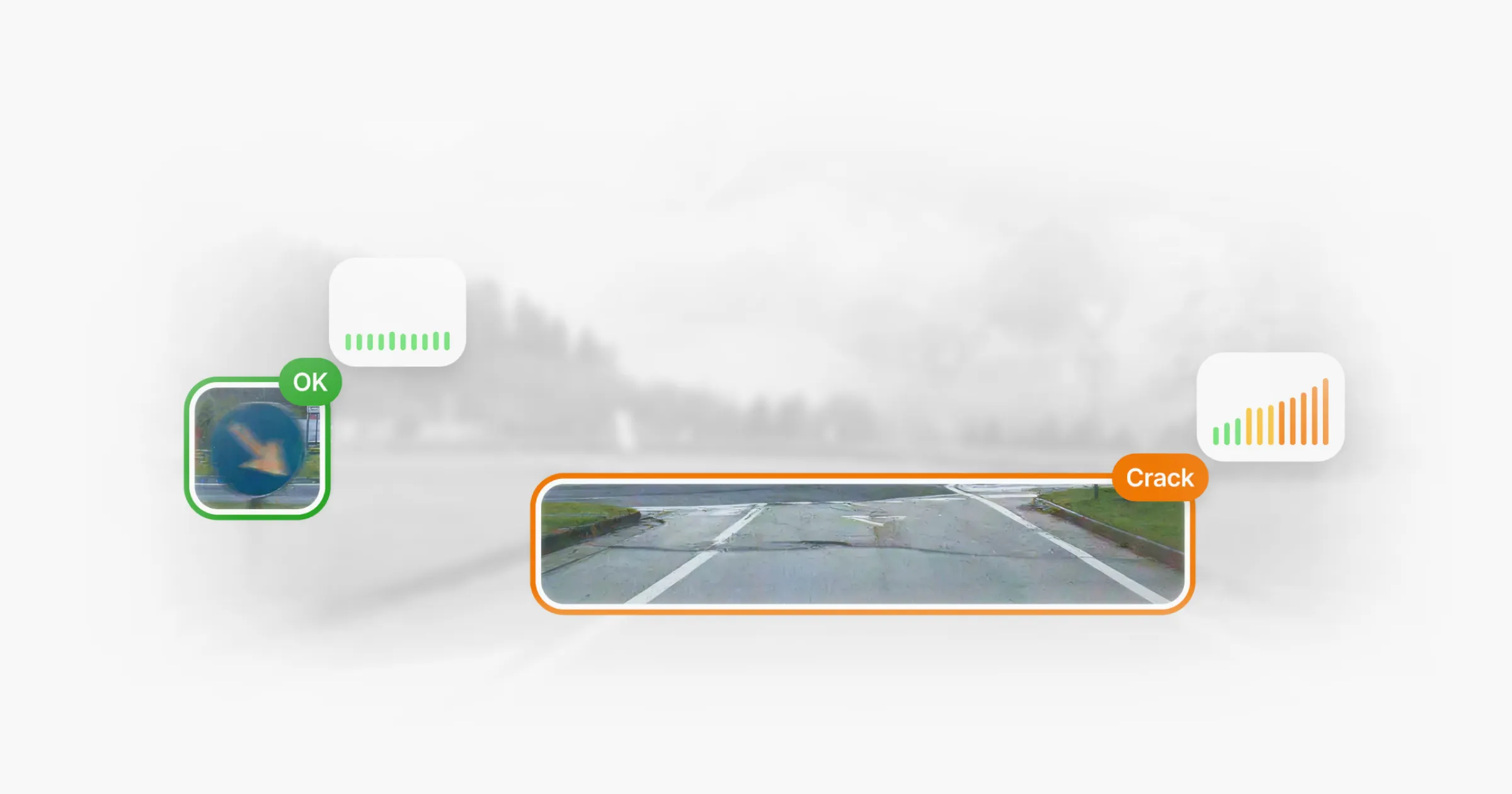
Det som förändras nu är inte grunderna i trafiksäkerhetsarbetet utan verktygen för att göra vägarnas tillstånd synligt i stor skala. System som Univrses 3DAI™ använder AI för att omvandla bilddata från fordon i vanlig trafik till strukturerad och jämförbar information. Det gör det möjligt att löpande följa förändringar och jämföra olika delar av stora vägnät, och använda informationen som ett konkret underlag i trafiksäkerhetsarbetet i stället för att främst behandla frågan som en underhållsfråga.
Vad ny forskning visar
Flera studier har undersökt hur faktorer som ojämnhet och friktion på vägen hänger samman med trafikolyckor. Genom att kombinera trafikdata, mätningar av vägytan och olycksstatistik har forskare kunnat undersöka sambandet över stora vägnät.
Högre olycksfrekvens på vägar i sämre skick
En ny studie från delstaten Iowa i USA analyserade detaljerade uppgifter om både trafikolyckor och vägarnas tillstånd på tusentals enskilda vägsträckor. Olycksdata kopplades till mätningar av vägytan, sträckorna klassificerades utifrån ojämnhet och friktion, och olycksfrekvensen beräknades i förhållande till trafikarbetet.
Skillnaderna var tydliga. På sträckor där beläggningen klassades som dålig registrerades 466 olyckor per cirka 161 miljoner fordonskilometer, jämfört med 134 på sträckor i gott skick. När forskarna tittade specifikt på friktion blev skillnaden ännu större. Sträckor med låg uppmätt friktion hade 571 olyckor vid samma trafikarbete, jämfört med 118 på sträckor med god friktion.
Detta är en observationsstudie och den visar därför inte i sig ett orsakssamband. Men samma mönster återkommer i resultaten: både större ojämnhet och sämre friktion hängde samman med betydligt fler olyckor, särskilt på vägar med låga och medelhöga hastigheter där en stor del av den dagliga trafiken sker.
Samma samband i större skala
Resultaten stöds av en större analys från den amerikanska vägmyndigheten Federal Highway Administration. Studien kombinerade friktionsmätningar och olycksdata från fler än 55 000 vägsträckor i fem delstater och undersökte hur uppmätt friktion hänger samman med olycksfrekvens på olika typer av vägar och platser.
I hela datamaterialet var högre friktion genomgående förknippad med färre olyckor. En ökning med tio enheter i uppmätt friktion motsvarade i genomsnitt omkring tio procent färre olyckor. På platser där väggreppet är särskilt viktigt, som i kurvor, korsningar och vid på- och avfarter, var sambandet ännu starkare. I flera fall låg den uppskattade minskningen på över 20 procent och ibland över 30 procent. Sambandet mellan friktion och olyckor var också starkare vid vått väglag än vid torrt.
Sammantaget visar studierna att faktorer som friktion och beläggningens skick går att mäta och återkommande hänger samman med olycksrisken på olika typer av vägar och i olika geografiska områden.

AI gör risker kopplade till vägytan mätbara i stor skala
För många vägmyndigheter har vägarnas tillstånd länge bedömts vid enstaka mättillfällen. Data om ojämnhet och friktion finns men samlas ofta in genom periodiska mätningar eller punktvisa tester. Det gör det svårt att hålla en aktuell och jämförbar bild av hur förhållandena förändras i hela vägnätet.
Artificiell intelligens förändrar nu förutsättningarna. Genom att analysera stora mängder bilder och annan data från fordon kan AI-baserade metoder omvandla observationerna till strukturerad och jämförbar information om vägytan. I stället för att förlita sig på enstaka kontroller kan utvecklingen följas betydligt oftare över tid.
3DAI™: Data för hela vägnätet
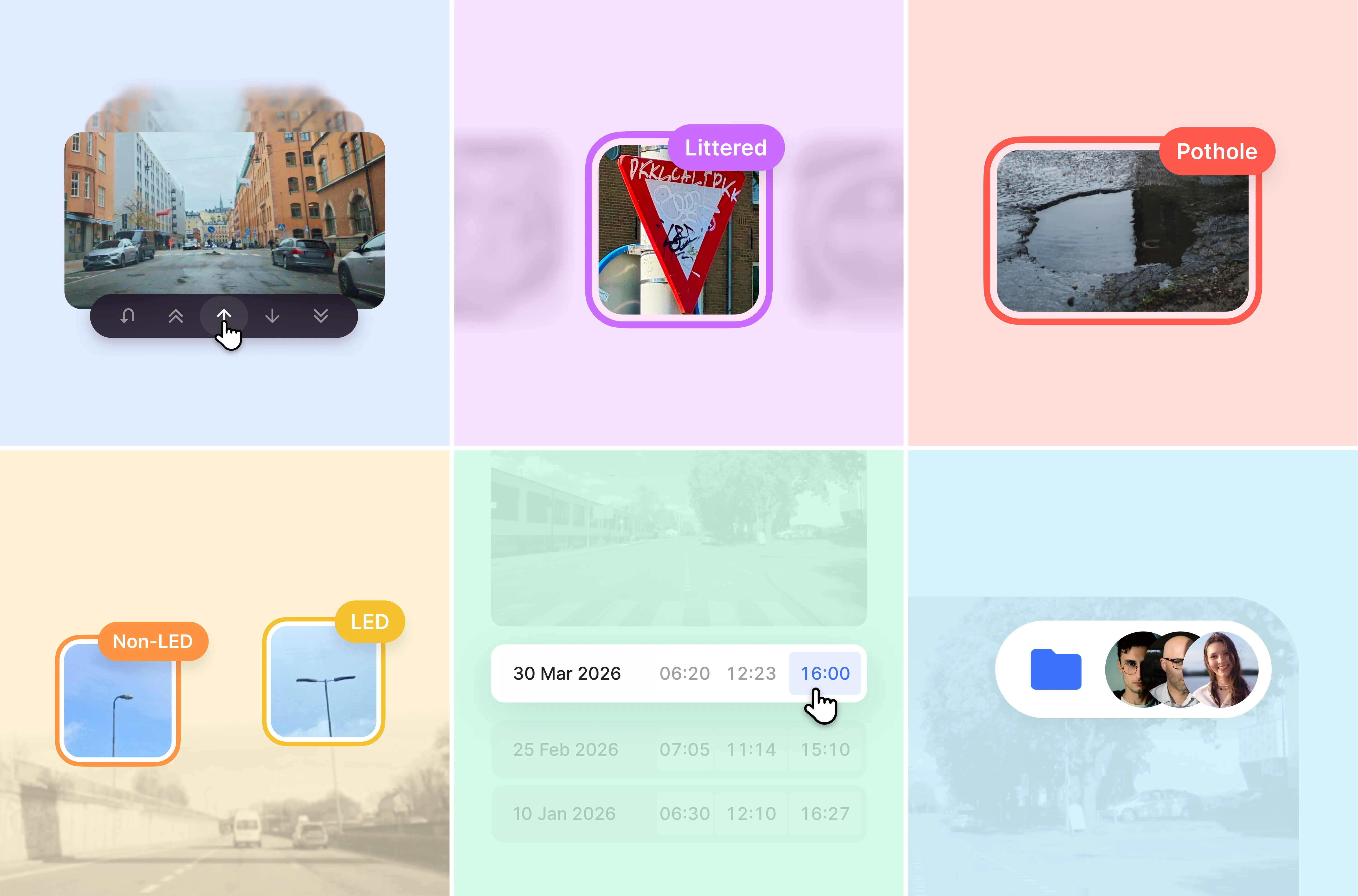
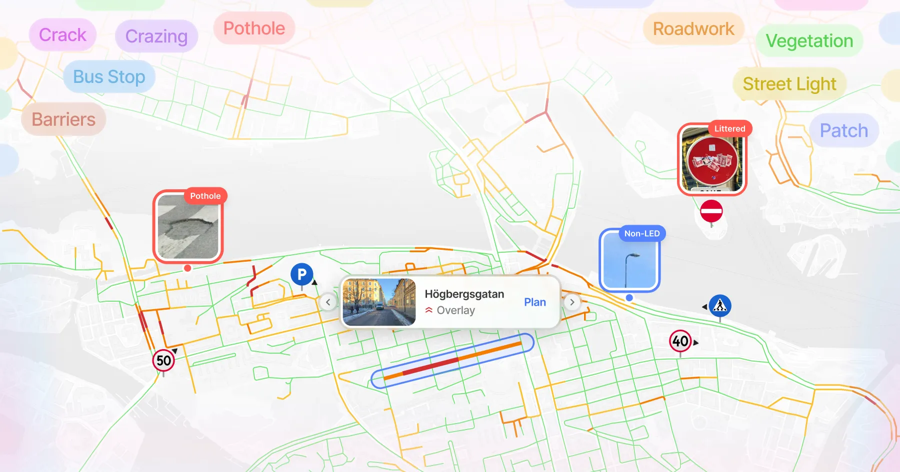
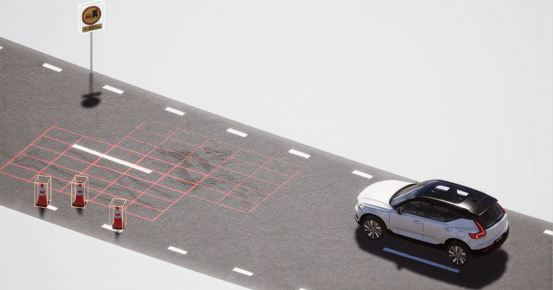
Univrses 3DAI™ är ett AI-baserat system som omvandlar fordonsdata, bland annat kamerabilder från fordon i vanlig trafik, till strukturerad information om vägytans tillstånd och den omgivande vägmiljön, kopplad till geografisk position. Systemet kan användas med kostnadseffektiva kameror som installeras i befintliga fordonsflottor. På så sätt kan stora vägnät kartläggas löpande utan att datainsamlingen behöver bygga på särskilda mätfordon eller inspektioner med långa mellanrum.
Mätvärden som friktion kan visa att något har förändrats på vägytan, men inte varför. 3DAI™ kompletterar den informationen med bilder från vägen. Myndigheter kan granska bilderna själva eller använda systemets AI för att identifiera potthål, sprickor, ytslitage och andra synliga skador.
Ur ett trafiksäkerhetsperspektiv innebär det att man inte bara kan upptäcka förändringar över tid utan också få bättre förståelse för vad som orsakar dem. När mätvärdena förändras kan bilddata hjälpa till att avgöra om orsaken är en faktisk nedbrytning av vägen som kräver underhåll, tillfälliga förhållanden som vatten på vägbanan eller ett mätresultat som inte motiverar någon åtgärd. Det minskar osäkerheten och ger ett bättre underlag för att avgöra var uppföljning behövs.
Detta gäller även andra delar av väginfrastrukturen. Skyltning, belysning och annan vägutrustning kan också registreras och struktureras med 3DAI™. Det ger en mer systematisk bild av de delar av infrastrukturen som kan påverka trafiksäkerheten och gör det lättare att ta hänsyn till dem i ett förebyggande säkerhetsarbete.

Så fungerar 3DAI™
1. Kamerabaserad skanning
Fordon utrustade med 3DAI™ skannar vägytan kontinuerligt under färd med hjälp av kameror.
2. AI-baserad detektion
Computer vision-modeller analyserar datan och identifierar och klassificerar bland annat sprickor, potthål, ytslitage och andra förändringar i vägytan.
3. Edge-bearbetning i enheten
Nyckeldata bearbetas direkt i enheten. Det minskar filstorlekar, sänker överföringskostnader och påskyndar den inledande analysen.
4. Validering i molnet
Resultaten laddas upp till molnet där de struktureras ytterligare och valideras inför kartläggning och vidare analys.
5. GPS-baserad kartläggning
Varje registrering kopplas till exakta GPS-koordinater och positioneras med hög precision i vägnätet.
6. Trendanalys
När samma vägar kartläggs återkommande kan 3DAI™ visa hur förhållandena förändras över tid. Det gör det lättare att se var vägarna fortsätter att försämras och var ytterligare uppföljning kan behövas.

AI som beslutsunderlag för trafiksäkerhet
Att integrera data om vägytor i säkerhetsrelaterade analyser kräver exakta och repeterbara insikter som uppfyller samma standarder som andra betrodda infrastrukturdata. Vägmyndigheter behöver vara trygga med att informationen de arbetar med är tillräckligt tillförlitlig för att kunna vägas in tillsammans med tekniska bedömningar, olycksstatistik och professionella bedömningar i säkerhetsanalyser.
Verifierad precision
3DAI™ har jämförts med etablerade metoder för att mäta vägarnas tillstånd. Oberoende utvärderingar från Statens väg- och transportforskningsinstitut, VTI, visar att resultaten från 3DAI™ ligger nära de värden som traditionella mätmetoder ger.
Anpassat för verkliga vägförhållanden
Till skillnad från mätningar som görs vid enstaka tillfällen används 3DAI™ löpande i många olika miljöer. När fordon utrustade med systemet körs på olika typer av vägar, beläggningar och under olika väderförhållanden utvecklas modellerna för att bättre spegla variationerna i verkliga trafikmiljöer.
Strukturerad data för prioritering
3DAI™ levererar vägdata i ett strukturerat och enhetligt format. Vägnätet delas in i jämförbara sträckor och data från återkommande körningar sammanställs över tid. Det gör det möjligt att se förändringsmönster i vägnätet i stället för att bara utgå från enskilda skador.
Informationen kan levereras via API eller webbgränssnitt och integreras i befintliga GIS- och analysprocesser. På så sätt kan den fungera som ett kompletterande underlag för prioritering och uppföljning.
3DAI™ i praktiken
3DAI™ används redan av flera städer och vägmyndigheter i Europa som stöd i arbetet med infrastrukturförvaltning. Användningen visar hur data om vägarnas tillstånd från hela vägnätet kan bli en del av den löpande planeringen, prioriteringen och uppföljningen.
Ett naturligt nästa steg är att undersöka hur den informationen hänger samman med registrerade trafikolyckor. I Sverige handlar det om att arbeta för att koppla 3DAI™:s data om vägytan till olycksdata i Trafikverkets STRADA-databas. Det skulle göra det möjligt att analysera sambandet över tid.
Läs mer om hur städer och myndigheter använder 3DAI™:
- England fick 110 000 gatlyktor klassificerade på 90 dagar
- Trafikverket gick från årliga vägmätningar till kontinuerlig monitorering av hela det svenska vägnätet
- Mesta och Statens Vegvesen använde 3DAI™ för att upptäcka skyltar och ytskador längs 17 459 km norska vägar
- Helsingborg minskade sina potthål med 70% på fem månader
- Tauragė i Litauen blev den första staden att använda 3DAI™ för monitorering av busshållplatser
En tydligare väg framåt
Vägarnas tillstånd har länge främst behandlats som en underhållsfråga snarare än som ett konkret underlag i trafiksäkerhetsanalyser. Ny forskning gör det svårare att se vägunderhåll och trafiksäkerhet som helt separata frågor. Flera datamaterial visar samma statistiska samband mellan mätbara egenskaper hos vägytan, bland annat beläggningens skick och friktion, och hur ofta olyckor inträffar.
Det som förändras nu är att risker kopplade till vägytan inte längre behöver bedömas indirekt eller enbart utifrån mätningar med långa mellanrum. När förhållandena på vägen kan följas oftare och jämföras över hela vägnätet blir informationen ett användbart underlag i ett mer förebyggande riskarbete. Det gäller särskilt på vägar i städer och på landsbygden, där de flesta dödsfallen sker och vägförhållandena varierar mest.
För vägmyndigheter handlar det inte om att ersätta etablerade trafiksäkerhetsåtgärder, utan om att komplettera det underlag som redan används. Med system som 3DAI™ går det att få en jämförbar bild av förhållandena i hela vägnätet. Det blir lättare att upptäcka förändringar, se var man behöver titta närmare och var uppföljning bör prioriteras. Den informationen kan vägas samman med olyckshistorik, tekniska bedömningar och lokalkännedom om vägnätet.
Ju bättre överblick, desto bättre möjligheter att agera. Med en samlad bild av vägarnas tillstånd kan risker kopplade till vägytan hanteras mer konsekvent och träffsäkert. Det bidrar till säkrare vägar.
Fortsätt läs





Använd i 15+ länder tillsammans med nationella vägmyndigheter och företag